Olperhutte Hike
Olperhutte Hike Route
Route: Olperhutte mountain via Freisenberghaus
Difficulty: Moderate
Distance: 9 miles / 14.5 km
Elevation change: 3050 feet / 930m
Estimated time: 5.5 - 7.5 hours (including breaks)
Rating: 10 / 10
Type of trail: Loop
Step by Step Directions
Getting to the start
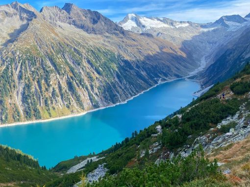
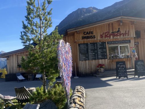
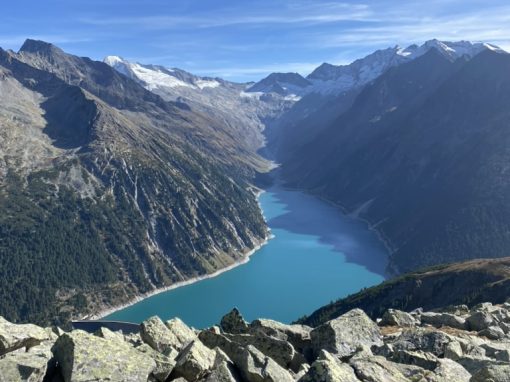
This hike starts at the Schlegeisspeicher reservoir. Best to get an early start and plan to begin at 10 am at the latest if you want to budget in time to enjoy the views and not rush. Reaching Schlegeisspeicher is easiest done by car, but there are also public bus options for those without a car. The reservoir is reached by traveling along the Schlegeis Alpine Road toll road. The toll road costs 15.50 euros per car and can only be paid in CASH. The road is typically open from May until mid October, but can vary depending on the season (ie - a colder autumn with early snowfall can close the road earlier). Be sure to check online to determine if the pass is open. The pass is open from the May to June and September to October from 7 am until 6 pm, and from 6 am until 6 pm in July and August. A portion of the road immediately after the pay point is a one-way road, so there may be a queue when you arrive. The pass is open in one direction for a period of time (usually 10 minutes) and then switched to the other direction. As you drive along this road, you will be thankful they operate the road with this system as there are sharp, hairpin turns on narrow roads which would be next to impossible with two-way traffic and there is a tunnel which is only suited for one-way traffic. It will take about 10 minutes to drive from the pay point to the base of the reservoir. You will exit a tunnel and immediately on your left will be a small café; note there are public bathrooms available here (helpful for before starting a long hike!). Ahead there will be signs for three parking lots. For those following the below path recommendation, parking in P1 will put you closets to the starting point of the hike, while parking in P3 will be closests to the end point. The walk between P1 to P3 is only about 10 minutes and along a flat road so not too challenging at either section. There is no additional charge for parking so pick a spot and get on your way. Take a peak at the reservoir from this level before commencing the hike.
Beginning the trek
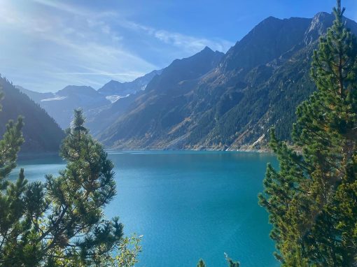
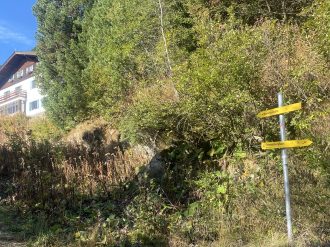
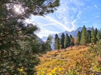
To find the starting point of the hike, head towards the direction of the tunnel you just drove through. Just past P1, but before the café and bathrooms area, there will be a path which starts on the left. If you look up to the left, you will see Dominikushutte. As you start on the path, follow the signs towards Friesenberhaus (2.5 hour) along trail 532. You will shortly see another sign pointing toward Friesenberhaus noting just 2 hours now. The trail will continue and you will pass over a small stream via a wooden plank. Continue upwards into the forest and on your way. You'll continue through trees for some time, with the mountains and reservoir poking through here and there. After some time, you will reach an area which opens up into a field. There are wooden planks along the path in a few areas here, helpful when the ground is wet as the area is a marsh. Soon you'll approach a little hut on your left, with running water available. Top off your water bottle and continue on your way. You'll have another hour or more from here until you reach Friesenberhaus. As you're above the tree line, most of this section is open and you'll have a large "rock field" that you wander through and around. You'll be able to spot Frisenberhaus long before you are there so keep an eye out and up for a view of the hut!
Continuing above the tree line
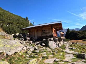
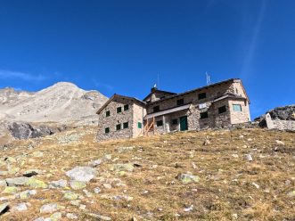
Once you reach Frisenberhaus, you're likely about 2-2.5 hours into your hike. The hut is open for hikers to book and stay overnight during the warmer summer months. With beautiful views, this is an excellent spot to take a break and enjoy a snack. You can even get lunch at the hut if you visit while it's open. The next portion of your hike will include a steep climb so fuel up here!
The steep uphill portion
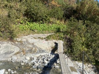
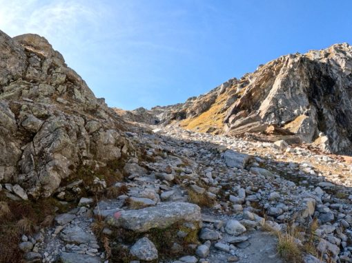
When you leave Frisenberhaus, follow the same path you took to reach the hut. Do not go behind the hut as these trails will lead to different destinations. You'll head down towards the Friesenbergsee Lake (body of water visible from the Frisenberhaus). Keep an eye out for a little wooden plank which sits over water. Cross the wooden plank and continue to follow the red and white trail markers on the rocks. This portion of the hike can sometimes be challenging to see in advance so the trail markers are especially helpful. You'll start an ascent immediately after crossing the water, eventually turning a corner and seeing a very steep climb to your left. Although daunting, it is not as bad as it looks, especially as you are only traversing up about 2/3 of the way (approx. 170 meters). This is the longest steep portion of the hike so power through and take breaks along the way to keep it an enjoyable hike.
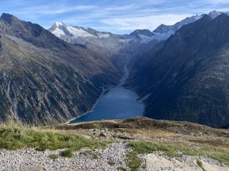
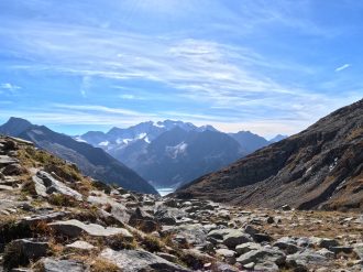
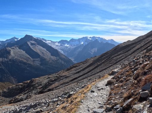
The path will eventually level off and you'll begin to walk along a mountainside trail. There are a few spots the path is quite narrow and there are often rocks in the ground requiring you to pay attention to your footing, but nothing too challenging to cover. You'll follow this lovely balcony trail for about 1 hour 30 minutes until you run into Olperhutte. Unlike Freisenbergsee, you will not see Olperhutte early and instead you will ultimately see the hut right as you are within five minutes of reaching it. Be sure to enjoy this section of the hike. The panoramic views of the mountains all around along with the reservoir beginning to peak through provides breathtaking views along the entire journey.
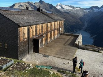
Arriving at Olperhutte
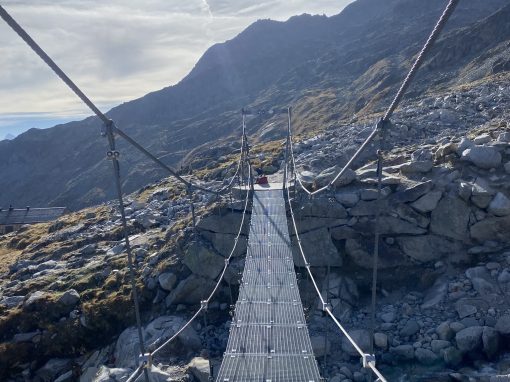
Once the Olperhutte shows its face, you'll also see the instagram famous bridge. Depending on when you are visiting, this might be quite busy as people queue to take their photo on the bridge with the optical illusion making it appear as they are on a bridge spanning over the reservoir, much higher than the reality of the photo as the bridge instead sits above a small stream. Plan to take another break here, getting your photos and enjoying a snack here too. If visiting from early June to early October, Olperhutte will be open so you can even grab a snack or bite to eat here!